| Listing 1 - 10 of 52 | << page >> |
Sort by
|
Book
ISBN: 0500400458 9780500400456 Year: 1985 Publisher: London : Thames and Hudson,
Abstract | Keywords | Export | Availability | Bookmark
 Loading...
Choose an application
- Reference Manager
- EndNote
- RefWorks (Direct export to RefWorks)
Book
ISBN: 9780520256521 Year: 2009 Publisher: Berkeley ; Los Angeles ; London University of California Press
Abstract | Keywords | Export | Availability | Bookmark
 Loading...
Choose an application
- Reference Manager
- EndNote
- RefWorks (Direct export to RefWorks)
Book
ISBN: 9061170052 Year: 1973 Publisher: Wageningen Deurne-Antwerpen Kluwer Algemene Boeken B.V. Kluwer-België N.V.
Abstract | Keywords | Export | Availability | Bookmark
 Loading...
Choose an application
- Reference Manager
- EndNote
- RefWorks (Direct export to RefWorks)
Geodesy. Cartography --- 912 --- Cartografie. Kaarten. Plattegronden. Atlassen --- Atlases, Dutch. --- 950.6
Book
ISBN: 9010019608 9789010019608 Year: 1977 Publisher: Sint-Stevens-Woluwe Elsevier
Abstract | Keywords | Export | Availability | Bookmark
 Loading...
Choose an application
- Reference Manager
- EndNote
- RefWorks (Direct export to RefWorks)
Intercontinental regions --- 912 --- Atlases, Dutch --- Dutch atlases --- Cartografie. Kaarten. Plattegronden. Atlassen --- Atlases, Dutch. --- Atlases

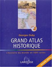
ISBN: 203521226X 9782035212269 Year: 2001 Publisher: Paris Larousse
Abstract | Keywords | Export | Availability | Bookmark
 Loading...
Choose an application
- Reference Manager
- EndNote
- RefWorks (Direct export to RefWorks)
930.9 --- 912 --- Wereldgeschiedenis --- Cartografie. Kaarten. Plattegronden. Atlassen --- 930.9 Wereldgeschiedenis --- 900.6

ISBN: 0195074181 Year: 1999 Publisher: New York ; Oxford Oxford University Press
Abstract | Keywords | Export | Availability | Bookmark
 Loading...
Choose an application
- Reference Manager
- EndNote
- RefWorks (Direct export to RefWorks)
Music --- biografieën (genre) --- jazz --- 78.39.1 --- 912 --- Muziekencyclopedieën en -naslagwerken --- Biografieën --- Encyclopedieën --- Jazz --- 20e eeuw

ISBN: 0333378784 0943818052 9780333378786 Year: 1984 Publisher: London Macmillan
Abstract | Keywords | Export | Availability | Bookmark
 Loading...
Choose an application
- Reference Manager
- EndNote
- RefWorks (Direct export to RefWorks)
muziek --- Music --- muziekinstrumenten --- Musical instruments --- Instruments de musique --- Dictionaries --- Dictionnaires anglais --- 912 --- Muziekencyclopedieën en -naslagwerken --- 78.40 --- Musique --- Dictionnaires

ISBN: 0691049459 069103169X 9780691031699 9780691049458 Year: 2000 Publisher: Princeton (N.J.) : Princeton university press,
Abstract | Keywords | Export | Availability | Bookmark
 Loading...
Choose an application
- Reference Manager
- EndNote
- RefWorks (Direct export to RefWorks)
Entreprise UAI 48 : Atlas du Monde Grec et Romain
912 <09> <37> --- 912 <09> <38> --- 930.9 --- 931: 912 --- Cartografie. Kaarten. Plattegronden. Atlassen--Geschiedenis van ...--Rome. Oud-Italië --- Cartografie. Kaarten. Plattegronden. Atlassen--Geschiedenis van ...--Oud-Griekenland --- Wereldgeschiedenis --- Oude geschiedenis--in het algemeen-:-Cartografie. Kaarten. Plattegronden. Atlassen --- Civilization, Classical. --- Greece --- Rome --- 931: 912 Oude geschiedenis--in het algemeen-:-Cartografie. Kaarten. Plattegronden. Atlassen --- 930.9 Wereldgeschiedenis --- Antiquity --- Civilization, Greco-Roman --- History, Ancient --- Historical geography --- Cartes --- Early works to 2100 --- Antiquities --- Antique, the --- Civilization, Greco-Roman - Maps. --- History, Ancient - Maps.

ISBN: 0226316335 9780226316338 0226316351 9780226316352 0226316378 9780226316376 0226907287 9780226907284 0226907333 9780226907338 0226907341 9780226907345 9780226907321 0226907325 0226907325 9780226184760 9780226184777 9780226534695 9780226534701 9780226534718 9780226184753 9780226339221 0226184773 0226184765 0226184757 Year: 1987 Volume: 2 Publisher: Chicago (Ill.) : University of Chicago press,
Abstract | Keywords | Export | Availability | Bookmark
 Loading...
Choose an application
- Reference Manager
- EndNote
- RefWorks (Direct export to RefWorks)
Since its launch in 1987, the History of Cartography series has garnered critical acclaim and sparked a new generation of interdisciplinary scholarship. Cartography in the European Enlightenment, the highly anticipated fourth volume, offers a comprehensive overview of the cartographic practices of Europeans, Russians, and the Ottomans, both at home and in overseas territories, from 1650 to 1800. The social and intellectual changes that swept Enlightenment Europe also transformed many of its mapmaking practices. A new emphasis on geometric principles gave rise to improved tools for measuring and mapping the world, even as large-scale cartographic projects became possible under the aegis of powerful states. Yet older mapping practices persisted: Enlightenment cartography encompassed a wide variety of processes for making, circulating, and using maps of different types. The volume’s more than four hundred encyclopedic articles explore the era’s mapping, covering topics both detailed—such as geodetic surveying, thematic mapping, and map collecting—and broad, such as women and cartography, cartography and the economy, and the art and design of maps. Copious bibliographical references and nearly one thousand full-color illustrations complement the detailed entries.
Geodesy. Cartography --- anno 500-1499 --- Prehistory --- Antiquity --- Cartography --- Cartographie --- Cartografie. --- History. --- Histoire. --- Cartography, Prehistoric --- 912 "04/14" --- 912 <09> <4> --- 912 <3> --- Cartography, Primitive --- Chartography --- Map-making --- Mapmaking --- Mapping (Cartography) --- Mathematical geography --- Surveying --- Map projection --- Maps --- Prehistoric cartography --- History --- Cartografie. Kaarten. Plattegronden. Atlassen--Middeleeuwen --- Cartografie. Kaarten. Plattegronden. Atlassen--Geschiedenis van ...--Europa --- Cartografie. Kaarten. Plattegronden. Atlassen--Plaatsaanduiding van de Oude Wereld --- 912 <09> <5> --- Cartografie. Kaarten. Plattegronden. Atlassen--Geschiedenis van ...--Azië --- 912 "15" --- Cartografie. Kaarten. Plattegronden. Atlassen--16e eeuw. Periode 1500-1599 --- 912 <09> <6> --- 912 <09> <7> --- 912 <09> <94> --- 912 <09> <98/99> --- Cartografie. Kaarten. Plattegronden. Atlassen--Geschiedenis van ...--Afrika --- Cartografie. Kaarten. Plattegronden. Atlassen--Geschiedenis van ...--Noord-Amerika. Midden-Amerika --- Cartografie. Kaarten. Plattegronden. Atlassen--Geschiedenis van ...--Australië --- Cartografie. Kaarten. Plattegronden. Atlassen--Geschiedenis van ...--Poolgebieden --- Africa --- Pacific Islands --- America --- Australia --- Arctica --- South Asia --- Asia --- Cartography - Europe - History --- anno 1400-1499 --- anno 1500-1599 --- Europe --- 912 <09> --- 912 --- Cartografie. Kaarten. Plattegronden. Atlassen--Geschiedenis van --- Cartografie. Kaarten. Plattegronden. Atlassen --- Cartography - Islamic countries - History. --- Cartography - South Asia - History. --- Cartography - History. --- anno 1600-1699 --- anno 1700-1799
Book
ISBN: 2717723722 9782717723724 Year: 2006 Publisher: Paris Bibliothèque nationale de France
Abstract | Keywords | Export | Availability | Bookmark
 Loading...
Choose an application
- Reference Manager
- EndNote
- RefWorks (Direct export to RefWorks)
Sans équivalent au monde, les grands globes peints que le cosmographe vénitien Vincerrao Coronelli réalisa pour Louis XIV à la demande du cardinal d'Estrées n'ont cessé, depuis leur création en 1683, de fasciner par leurs dimensions -quatre mètres de diamètre, deux tonnes chacun et par la qualité de leurs peintures. Hymne à la gloire du Roi identifié au Soleil qui éclaire le monde, le globe terrestre, fourmillant de détails exotiques et d'inscriptions, est à rattacher aux efforts de Colbert pour étendre le champ du commerce extérieur de la France en la dotant notamment d'une marine et d'une cartographie ; le globe céleste, d'un bleu profond, qui recompose, sous le pinceau des meilleurs peintres, les constellations telles qu'elles étaient en septembre 1638 au jour de la naissance de Louis XIV est l'une; des plus belles encyclopédies des astres. Depuis leur création jusqu'à leur réinstallation à la Bibliothèque nationale de France, dans son site de Tolbiac, ces gigantesques sphères n'ont cessé d'être déplacées, montées démontées mises en caisses, exposées dans divers bâtiments tant à Marl, Versailles et Paris, parfois pour quelques mois seulement. Exposés au public, ces chefs-d'œuvre de la cartographie baroque qui nous permettent de contempler le monde tel qu'il s'offrait à la lin du XVIIe siècle vont enfin pouvoir donner lieu aux recherches qu'ils méritent dans bous les domaines de l'histoire des sciences et de l'histoire de l'art. Voici, remarquablement illustrée, une visite savante et savoureuse, guidée par Hélène Richard, directeur du département des Cartes et Plans de la BNF, qui veille sur ces précieux présents royaux.
Globes --- Celestial globes --- 912.643 --- 912 <09> <45> --- 912 "16" --- Cartografie. Kaarten. Plattegronden. Atlassen--Geschiedenis van ...--Italië --- Cartografie. Kaarten. Plattegronden. Atlassen--17e eeuw. Periode 1600-1699 --- Cartographic materials --- Orbs --- World maps --- Globes, Celestial --- Globes, Star --- Star globes --- Astronomical models --- Celestial sphere --- Coronelli, Vincenzo, --- Coronelli, Marco Vincenzo, --- Coronelli, Vicenzo Maria, --- Corneille, Marc Vicent, --- Bibliothèque nationale (France). --- Paris. --- Coronelli, Vincenzo --- Cartografie. Kaarten. Plattegronden. Atlassen--Geschiedenis van ...--Italië --- Globes - Exhibitions. --- Celestial globes - Exhibitions. --- Acqui 2006
| Listing 1 - 10 of 52 | << page >> |
Sort by
|

 Search
 Feedback
 About
About Help
Help News
News